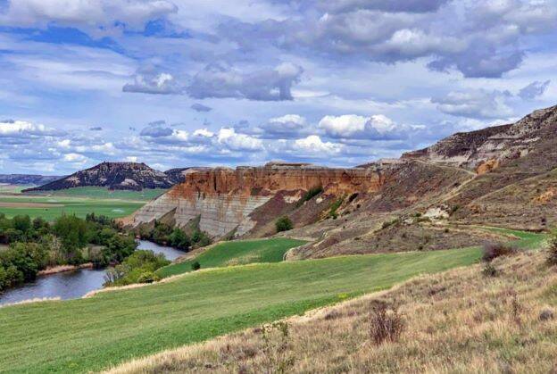
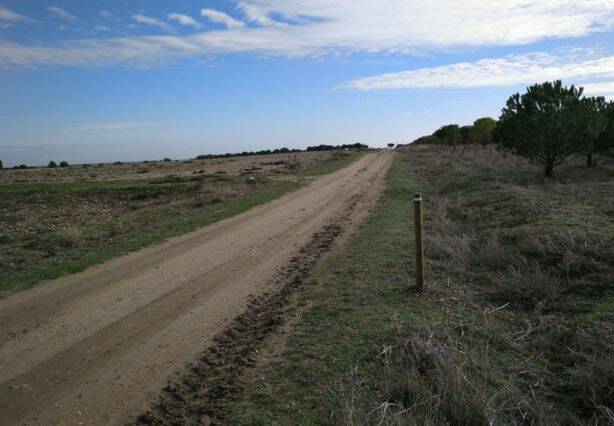
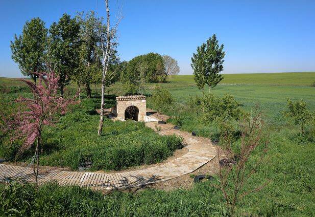
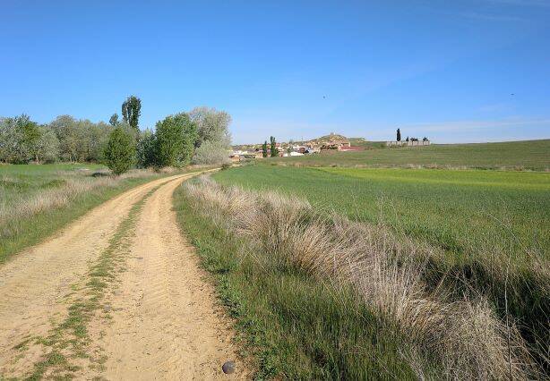
Valladolid
PRc-va8 senda de los cortados (cabezón de pisuerga)
Distância: 8,9 kms
Duração: 2h20m
Tipo: Circular
Dificuldade: Baixa
![](https://primary.jwwb.nl/public/t/f/x/temp-wponflgqgidooaehutvz/xrcfpv/square_6a306b326f723938306f.jpg?enable-io=true&enable=upscale&crop=624%2C419%2Cx0%2Cy0%2Csafe&width=344&height=231)
![](https://primary.jwwb.nl/public/t/f/x/temp-wponflgqgidooaehutvz/xgcylh/Novaimagem-413.bmp?enable-io=true&enable=upscale&crop=1106%2C236%2Cx0%2Cy0%2Csafe&width=860&height=183)
PRc-va16 camiño de vecilla (cabezón de pisuerga)
Distância: 6 kms
Duração: 2h00m
Tipo: Circular
Dificuldade: Baixa
![](https://primary.jwwb.nl/public/t/f/x/temp-wponflgqgidooaehutvz/cn8cfw/square_35306833316631653932.jpg?enable-io=true&enable=upscale&crop=648%2C404%2Cx0%2Cy0%2Csafe&width=377&height=235)
![](https://primary.jwwb.nl/public/t/f/x/temp-wponflgqgidooaehutvz/xqr9xv/Novaimagem-414.bmp?enable-io=true&enable=upscale&crop=1102%2C237%2Cx1%2Cy0%2Csafe&width=860&height=185)
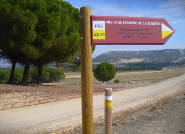
PRc-va20 sendero de la sombría (santibáñez de valcorba)
Distância: 7,2 kms
Duração: 2h00m
Tipo: Circular
Dificuldade: Baixa
![](https://primary.jwwb.nl/public/t/f/x/temp-wponflgqgidooaehutvz/y02m1l/square_78366330756330347072.jpg?enable-io=true&enable=upscale&crop=600%2C435%2Cx1%2Cy0%2Csafe&width=324&height=235)
![](https://primary.jwwb.nl/public/t/f/x/temp-wponflgqgidooaehutvz/ituuev/Novaimagem-415.bmp?enable-io=true&enable=upscale&crop=1102%2C237%2Cx1%2Cy0%2Csafe&width=860&height=185)
PRc-va21 sendero de valcorba (santibáñez de valcorba)
Distância: 7,5 kms
Duração: 2h15m
Tipo: Circular
Dificuldade: Baixa
![](https://primary.jwwb.nl/public/t/f/x/temp-wponflgqgidooaehutvz/inzwq1/square_79737239686c396d656d.jpg?enable-io=true&enable=upscale&crop=601%2C436%2Cx0%2Cy0%2Csafe&width=324&height=235)
![](https://primary.jwwb.nl/public/t/f/x/temp-wponflgqgidooaehutvz/r53vux/Novaimagem-416.bmp?enable-io=true&enable=upscale&crop=1106%2C237%2Cx0%2Cy0%2Csafe&width=860&height=184)
PRc-va22 sendero de las viñas (santibáñez de valcorba)
Distância: 3,7 kms
Duração: 1h00m
Tipo: Circular
Dificuldade: Baixa
![](https://primary.jwwb.nl/public/t/f/x/temp-wponflgqgidooaehutvz/4z687h/square_76616c66616137763933.jpg?enable-io=true&enable=upscale&crop=593%2C441%2Cx1%2Cy0%2Csafe&width=324&height=241)
![](https://primary.jwwb.nl/public/t/f/x/temp-wponflgqgidooaehutvz/z8ih6d/Novaimagem-417.bmp?enable-io=true&enable=upscale&crop=1102%2C237%2Cx0%2Cy0%2Csafe&width=860&height=185)
PR-va27 tren burra (zaratán)
Distância: 3,5 kms
Duração: 1h00m
Tipo: Linear
Dificuldade: Baixa
![](https://primary.jwwb.nl/public/t/f/x/temp-wponflgqgidooaehutvz/2mnn27/square_78723776726638667375.jpg?enable-io=true&enable=upscale&crop=683%2C383%2Cx1%2Cy0%2Csafe&width=369&height=207)
![](https://primary.jwwb.nl/public/t/f/x/temp-wponflgqgidooaehutvz/mxgzky/Novaimagem-418.bmp?enable-io=true&enable=upscale&crop=1107%2C236%2Cx0%2Cy0%2Csafe&width=860&height=183)
PRc-va28 entre campiñas y humedales (aldeamayor de san martín)
Distância: 14,8 kms
Duração: 3h30m
Tipo: Circular
Dificuldade: Média
![](https://primary.jwwb.nl/public/t/f/x/temp-wponflgqgidooaehutvz/20st7t/square_77357965773577736435.jpg?enable-io=true&enable=upscale&crop=634%2C413%2Cx0%2Cy0%2Csafe&width=369&height=240)
![](https://primary.jwwb.nl/public/t/f/x/temp-wponflgqgidooaehutvz/98xd5x/Novaimagem-419.bmp?enable-io=true&enable=upscale&crop=1109%2C236%2Cx0%2Cy0%2Csafe&width=860&height=183)
PRc-va30 senda del cega (mojados)
Distância: 10,5 kms
Duração: 3h00m
Tipo: Circular
Dificuldade: Média
![](https://primary.jwwb.nl/public/t/f/x/temp-wponflgqgidooaehutvz/iwmqar/square_346e63666b6135647568.jpg?enable-io=true&enable=upscale&crop=579%2C452%2Cx0%2Cy0%2Csafe&width=272&height=212)
![](https://primary.jwwb.nl/public/t/f/x/temp-wponflgqgidooaehutvz/55u49d/Novaimagem-420.bmp?enable-io=true&enable=upscale&crop=1102%2C237%2Cx0%2Cy0%2Csafe&width=860&height=185)
PRc-va31 pino pinilla (portilla)
Distância: 12,1 kms
Duração: 3h10m
Tipo: Circular
Dificuldade: Média
![](https://primary.jwwb.nl/public/t/f/x/temp-wponflgqgidooaehutvz/mt0kyy/square_32746e363964686a3179.jpg?enable-io=true&enable=upscale&crop=599%2C437%2Cx0%2Cy0%2Csafe&width=277&height=202)
![](https://primary.jwwb.nl/public/t/f/x/temp-wponflgqgidooaehutvz/9eg7ts/Novaimagem-421.bmp?enable-io=true&enable=upscale&crop=1102%2C237%2Cx1%2Cy0%2Csafe&width=860&height=185)
PRc-va32 sendero de negredo (traspinedo)
Distância: 6,3 kms
Duração: 1h35m
Tipo: Circular
Dificuldade: Média
![](https://primary.jwwb.nl/public/t/f/x/temp-wponflgqgidooaehutvz/581sjt/square_6f30723271747373336d.jpg?enable-io=true&enable=upscale&crop=610%2C429%2Cx0%2Cy0%2Csafe&width=332&height=233)
![](https://primary.jwwb.nl/public/t/f/x/temp-wponflgqgidooaehutvz/c38bw4/Novaimagem-422.bmp?enable-io=true&enable=upscale&crop=1102%2C237%2Cx2%2Cy0%2Csafe&width=860&height=185)
PRc-va33 camiño de nivaria (matapozuelos)
Distância: 9,8 kms
Duração: 2h10m
Tipo: Circular
Dificuldade: Média
![](https://primary.jwwb.nl/public/t/f/x/temp-wponflgqgidooaehutvz/oaqnm9/square_376b62656f666a626862.jpg?enable-io=true&enable=upscale&crop=684%2C382%2Cx0%2Cy0%2Csafe&width=418&height=233)
![](https://primary.jwwb.nl/public/t/f/x/temp-wponflgqgidooaehutvz/eb77gb/Novaimagem-423.bmp?enable-io=true&enable=upscale&crop=1106%2C236%2Cx0%2Cy0%2Csafe&width=860&height=183)
PRc-va34 ruta del viño de rueda (medina del campo)
Distância: 40 kms
Duração: 10h00m
Tipo: Circular
Dificuldade: Alta
![](https://primary.jwwb.nl/public/t/f/x/temp-wponflgqgidooaehutvz/sk8zms/square_646a6b35713462756433.jpg?enable-io=true&enable=upscale&crop=604%2C433%2Cx0%2Cy0%2Csafe&width=324&height=232)
![](https://primary.jwwb.nl/public/t/f/x/temp-wponflgqgidooaehutvz/u16sfq/Novaimagem-424.bmp?enable-io=true&enable=upscale&crop=1102%2C237%2Cx0%2Cy0%2Csafe&width=860&height=185)
PRc-va36 el alcornocal de foncastín (rueda)
Distância: 9,1 kms
Duração: 2h00m
Tipo: Circular
Dificuldade: Média
![](https://primary.jwwb.nl/public/t/f/x/temp-wponflgqgidooaehutvz/xe6e2u/square_39367664763668633169.jpg?enable-io=true&enable=upscale&crop=594%2C441%2Cx0%2Cy0%2Csafe&width=324&height=240)
![](https://primary.jwwb.nl/public/t/f/x/temp-wponflgqgidooaehutvz/978rez/Novaimagem-425.bmp?enable-io=true&enable=upscale&crop=1102%2C237%2Cx1%2Cy0%2Csafe&width=860&height=185)
PRc-va37 sendero de sofraga (rueda)
Distância: 23,4 kms
Duração: 5h50m
Tipo: Circular
Dificuldade: Média
![](https://primary.jwwb.nl/public/t/f/x/temp-wponflgqgidooaehutvz/u8o8gc/square_6662616f6b6f786e6472.jpg?enable-io=true&enable=upscale&crop=708%2C369%2Cx1%2Cy0%2Csafe&width=418&height=218)
![](https://primary.jwwb.nl/public/t/f/x/temp-wponflgqgidooaehutvz/8zwjmk/Novaimagem-426.bmp?enable-io=true&enable=upscale&crop=1102%2C237%2Cx1%2Cy0%2Csafe&width=860&height=185)
PRc-va38 sendero de la resina (rueda)
Distância: 7,9 kms
Duração: 2h00m
Tipo: Circular
Dificuldade: Média
![](https://primary.jwwb.nl/public/t/f/x/temp-wponflgqgidooaehutvz/bzm016/square_696e783379797337616f.jpg?enable-io=true&enable=upscale&crop=591%2C443%2Cx0%2Cy0%2Csafe&width=272&height=204)
![](https://primary.jwwb.nl/public/t/f/x/temp-wponflgqgidooaehutvz/kokpmu/Novaimagem-427.bmp?enable-io=true&enable=upscale&crop=1106%2C236%2Cx0%2Cy0%2Csafe&width=860&height=183)
PR-va41 sendero de las fuentes de quintanilla de arriba (quintanilla de arriba)
Distância: 11,7 kms
Duração: 6h20m
Tipo: Linear
Dificuldade: Alta
![](https://primary.jwwb.nl/public/t/f/x/temp-wponflgqgidooaehutvz/2ouk7p/square_303733346d706a616870.jpg?enable-io=true&enable=upscale&crop=651%2C402%2Cx0%2Cy0%2Csafe&width=418&height=258)
![](https://primary.jwwb.nl/public/t/f/x/temp-wponflgqgidooaehutvz/aswi84/Novaimagem-428.bmp?enable-io=true&enable=upscale&crop=1102%2C237%2Cx1%2Cy0%2Csafe&width=860&height=185)
PRc-va42 sendero del río eresma (hornillos de eresma)
Distância: 8,7 kms
Duração: 2h10m
Tipo: Circular
Dificuldade: Média
![](https://primary.jwwb.nl/public/t/f/x/temp-wponflgqgidooaehutvz/6501fp/square_627872696e613630786b.jpg?enable-io=true&enable=upscale&crop=591%2C443%2Cx0%2Cy0%2Csafe&width=309&height=232)
![](https://primary.jwwb.nl/public/t/f/x/temp-wponflgqgidooaehutvz/cogexf/Novaimagem-429.bmp?enable-io=true&enable=upscale&crop=1106%2C237%2Cx0%2Cy0%2Csafe&width=860&height=184)
PRc-va49 senda de la atalaya (traspinedo)
Distância: 5,4 kms
Duração: 1h15m
Tipo: Circular
Dificuldade: Média
![](https://primary.jwwb.nl/public/t/f/x/temp-wponflgqgidooaehutvz/ob4uab/square_75646337727769366c30.jpg?enable-io=true&enable=upscale&crop=617%2C424%2Cx0%2Cy0%2Csafe&width=341&height=234)
![](https://primary.jwwb.nl/public/t/f/x/temp-wponflgqgidooaehutvz/rkj1l0/Novaimagem-430.bmp?enable-io=true&enable=upscale&crop=1102%2C237%2Cx1%2Cy0%2Csafe&width=860&height=185)
PRc-va44 camiño del berral (sardón de duero)
Distância: 8,2 kms
Duração: 2h15m
Tipo: Circular
Dificuldade: Média
![](https://primary.jwwb.nl/public/t/f/x/temp-wponflgqgidooaehutvz/fsb3hz/square_377938376a6d79776271.jpg?enable-io=true&enable=upscale&crop=602%2C434%2Cx0%2Cy0%2Csafe&width=322&height=232)
![](https://primary.jwwb.nl/public/t/f/x/temp-wponflgqgidooaehutvz/t2luks/Novaimagem-431.bmp?enable-io=true&enable=upscale&crop=1108%2C236%2Cx0%2Cy0%2Csafe&width=860&height=183)
PR-va45 entre viñas (serrada)
Distância: 7,6 kms
Duração: 1h50m
Tipo: Linear
Dificuldade: Média
![](https://primary.jwwb.nl/public/t/f/x/temp-wponflgqgidooaehutvz/lnhui0/square_63746f70726374716e73.jpg?enable-io=true&enable=upscale&crop=597%2C438%2Cx1%2Cy0%2Csafe&width=282&height=207)
![](https://primary.jwwb.nl/public/t/f/x/temp-wponflgqgidooaehutvz/bbwao3/Novaimagem-432.bmp?enable-io=true&enable=upscale&crop=1102%2C237%2Cx0%2Cy0%2Csafe&width=860&height=185)
slc-va46 ruta de las canteras (benafarces)
Distância: 6,7 kms
Duração: 1h45m
Tipo: Circular
Dificuldade: Média
![](https://primary.jwwb.nl/public/t/f/x/temp-wponflgqgidooaehutvz/aqakp8/square_39337237667865723263.jpg?enable-io=true&enable=upscale&crop=595%2C440%2Cx0%2Cy0%2Csafe&width=314&height=232)
![](https://primary.jwwb.nl/public/t/f/x/temp-wponflgqgidooaehutvz/bnewon/Novaimagem-433.bmp?enable-io=true&enable=upscale&crop=1102%2C237%2Cx2%2Cy0%2Csafe&width=860&height=185)
sl-va56 del llano al vALHONDO (MOJADOS)
Distância: 6,8 kms
Duração: 1h40m
Tipo: Linear
Dificuldade: Média
![](https://primary.jwwb.nl/public/t/f/x/temp-wponflgqgidooaehutvz/x0xhqc/square_6f33686d73626f706334.jpg?enable-io=true&enable=upscale&crop=614%2C427%2Cx0%2Cy0%2Csafe&width=314&height=218)
![](https://primary.jwwb.nl/public/t/f/x/temp-wponflgqgidooaehutvz/gt5h1i/Novaimagem-434.bmp?enable-io=true&enable=upscale&crop=1102%2C237%2Cx1%2Cy0%2Csafe&width=860&height=185)
sl-va51 camiño de las fuentes (bustillo de chaves)
Distância: 1,4 kms
Duração: 0h35m
Tipo: Linear
Dificuldade: Baixa
![](https://primary.jwwb.nl/public/t/f/x/temp-wponflgqgidooaehutvz/5vuwzx/square_6a776d777477366b6230.jpg?enable-io=true&enable=upscale&crop=618%2C424%2Cx0%2Cy0%2Csafe&width=342&height=235)
![](https://primary.jwwb.nl/public/t/f/x/temp-wponflgqgidooaehutvz/ddeswa/Novaimagem-435.bmp?enable-io=true&enable=upscale&crop=1107%2C236%2Cx0%2Cy0%2Csafe&width=860&height=183)
sl-va50 sendero de bustillo (villanueva de la condesa)
Distância: 2,7 kms
Duração: 1h10m
Tipo: Linear
Dificuldade: Média
![](https://primary.jwwb.nl/public/t/f/x/temp-wponflgqgidooaehutvz/3grty3/square_7333766768636b396a77.jpg?enable-io=true&enable=upscale&crop=614%2C426%2Cx0%2Cy0%2Csafe&width=335&height=232)
![](https://primary.jwwb.nl/public/t/f/x/temp-wponflgqgidooaehutvz/tj4g1o/Novaimagem-436.bmp?enable-io=true&enable=upscale&crop=1102%2C237%2Cx1%2Cy0%2Csafe&width=860&height=185)
slc-va52 sendero de las aromáticas (villalbarba)
Distância: 2 kms
Duração: 0h40m
Tipo: Circular
Dificuldade: Baixa
![](https://primary.jwwb.nl/public/t/f/x/temp-wponflgqgidooaehutvz/rwz2k0/square_37786174797636657373.jpg?enable-io=true&enable=upscale&crop=600%2C436%2Cx0%2Cy0%2Csafe&width=335&height=243)
![](https://primary.jwwb.nl/public/t/f/x/temp-wponflgqgidooaehutvz/pg4fgn/Novaimagem-437.bmp?enable-io=true&enable=upscale&crop=1102%2C237%2Cx2%2Cy0%2Csafe&width=860&height=185)